









LOS ANGELES, CA – Long Beach is preparing for another round of powerful ocean swells as Hurricane Polo moves toward Mexico, with high tides and elevated surf expected to increase the risk of flooding and additional erosion along the city’s vulnerable coastline.
The greatest concern is focused on the Long Beach Peninsula and Belmont Shore, where city officials have urged residents to prepare for high tides and swell activity through Wednesday, Sept. 30.
The City of Long Beach Department of Disaster Preparedness is coordinating preparedness information as the city continues to deal with damage left by Hurricane Marie earlier this month.
Polo swells expected to reach Long Beach
Hurricane Polo is not expected to make landfall in California. Instead, its effects on Southern California are expected primarily through ocean swells generated by the storm.
The National Weather Service in Los Angeles/Oxnard said Sunday that coastal impacts from tropical cyclones well south of Southern California are expected to peak Monday and Tuesday, with high surf, beach erosion and possible coastal flooding.
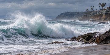
A current NWS coastal hazard statement calls for a High Surf Advisory from 5 a.m. Monday through 5 p.m. Tuesday for Los Angeles County beaches. Breaking waves of 4 to 7 feet are expected, along with dangerous rip currents. A Coastal Flood Advisory is also in effect during the same period.
Forecasters said the combination of elevated surf and high tides could produce moderate flooding in vulnerable coastal locations.
Long Beach Peninsula remains especially vulnerable
The concern in Long Beach comes only weeks after Hurricane Marie produced major waves and coastal damage along the Peninsula.
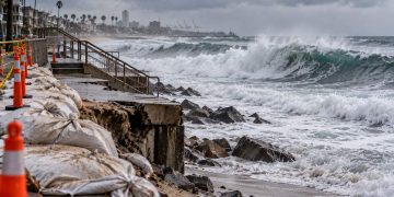
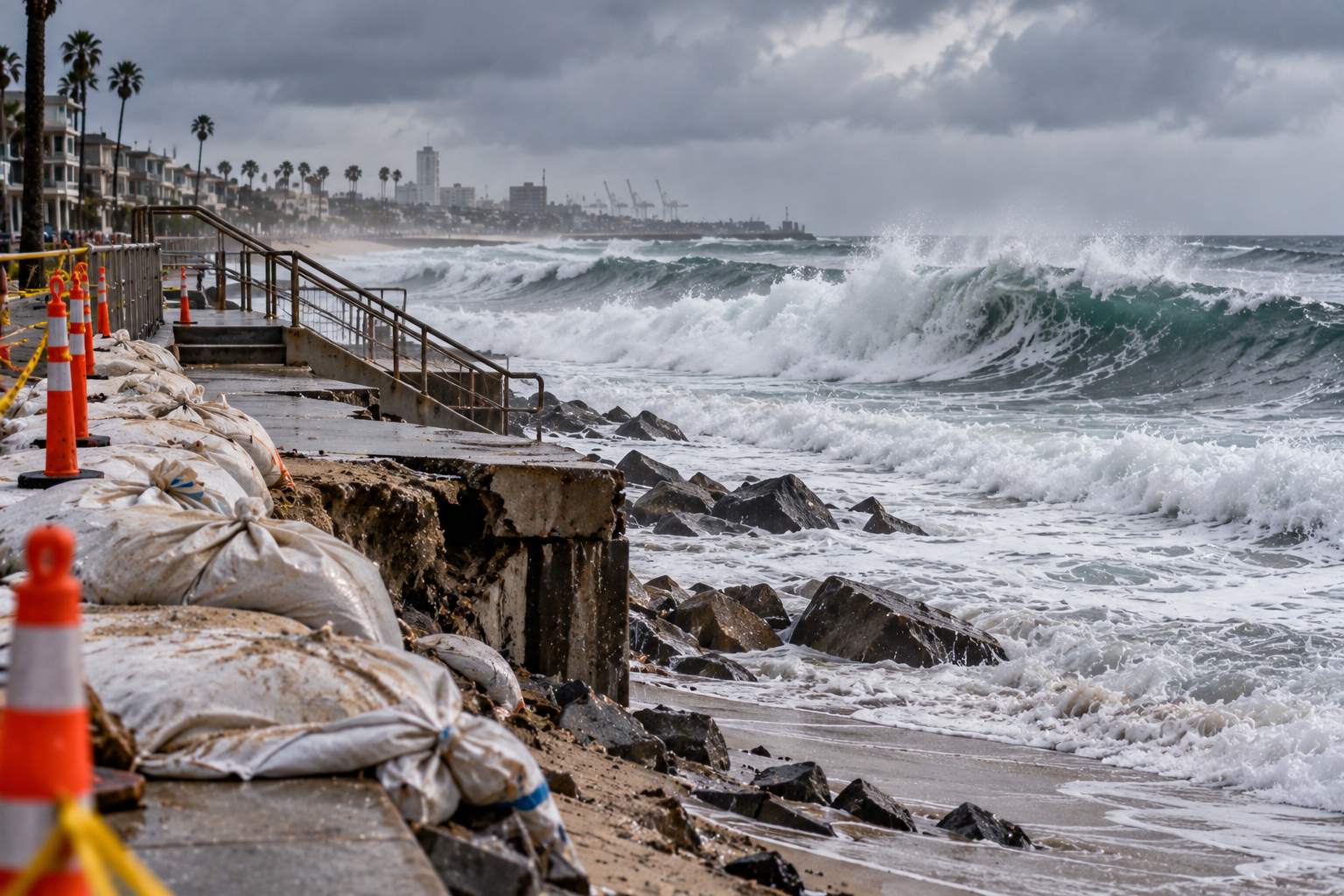
The earlier storm removed substantial amounts of sand from portions of the shoreline and damaged sections of the pedestrian boardwalk and coastal infrastructure.
That loss of sand leaves some areas with less natural protection between incoming waves and the structures along the Peninsula.
The city has therefore continued emergency work while preparing for Polo’s arrival, including efforts to reinforce vulnerable portions of the boardwalk and protect the shoreline.
The City of Long Beach’s emergency preparedness resources identify flooding and other coastal hazards among the risks the city prepares for because of its location along the Pacific.
City testing temporary wave protection
Long Beach is also testing a temporary approach designed to reduce the amount of water and wave energy reaching vulnerable sections of the Peninsula.
City crews have been using large, heavy-duty sandbags to temporarily reinforce portions of the bulkhead.
The city is also continuing work on vulnerable sections of the pedestrian boardwalk.
At the 72nd Place parking lot, K-rails are being kept in place as another measure intended to reduce water intrusion. The city said the approach was successfully tested during the previous coastal emergency.
These measures are intended to provide additional protection while the coastline remains exposed to another period of elevated surf.
Peninsula beach closed for safety
The city has closed the beach along the Peninsula as a public-safety measure while the storm impacts develop.
Residents have also been advised to stay off sand berms and away from areas where heavy equipment is operating.
The warnings are particularly relevant along portions of the Peninsula where crews are actively working to reinforce coastal defenses.
Residents in vulnerable areas have also been encouraged to prepare their properties before the highest-risk period arrives.
Sand and sandbags available
Long Beach has made sand and sandbags available to residents at the Claremont Parking Lot, 5400 E. Ocean Blvd.
According to city preparedness information released for the storm, crews are available to assist residents from 8 a.m. to 6 p.m.
Sand and sandbags are not being distributed at the Lifeguard Station at 72nd Place because of ongoing city storm operations.
Residents can also use the city’s Alert Long Beach emergency notification system for emergency information and updates.
The city’s disaster preparedness department says its mission includes protecting lives and property through planning, training, communication and coordinated emergency response.
High tides could worsen flooding
The timing of the incoming swells is an important part of the forecast.
The NWS expects high tides to coincide with the period of elevated surf, increasing the potential for water to reach areas that normally remain above the shoreline.
The latest coastal hazard statement for Los Angeles County warns of moderate coastal flooding, while also cautioning about dangerous rip currents and breaking waves.
The NWS has specifically identified low-lying coastal areas, including waterfront roads, parking areas and other vulnerable locations, as places where shallow flooding can occur during elevated water levels.
For Long Beach, the combination is particularly significant because portions of the Peninsula are still recovering from the previous storm.
Polo remains well offshore
As of Sunday, Hurricane Polo remained over the eastern Pacific and was forecast to move toward Baja California.
The National Hurricane Center reported Sunday morning that Polo had maximum sustained winds of about 125 mph and was moving north-northwest at roughly 12 mph. The storm was located hundreds of miles southwest of Cabo San Lucas.
The forecast track called for Polo to approach Baja California Sur on Monday before continuing across the peninsula and toward northwestern Mexico.
That trajectory keeps the hurricane itself away from Southern California, but its large ocean circulation is still capable of generating swells that travel north toward the coast.
The NWS Los Angeles/Oxnard office said the main Southern California impacts are expected to be coastal rather than direct hurricane conditions.
Another test for a coastline already damaged
For Long Beach, the timing of Polo’s swells means the city is preparing for another coastal test while repairs and reinforcement work from the previous storm are still underway.
The city has declared a local emergency related to the coastal damage and broader El Niño preparedness, allowing officials to continue emergency planning and response measures as conditions develop.
The current preparations focus on limiting additional wave impacts, protecting vulnerable infrastructure and giving residents time to prepare before the highest tides and surf arrive.
The Long Beach Department of Disaster Preparedness and Emergency Communications provides emergency resources and preparedness information for residents, including access to local alerts and guidance for coastal hazards.
With the highest coastal risks expected Monday and Tuesday, Long Beach officials are continuing to monitor the shoreline as Hurricane Polo’s swells move north. The NWS currently expects elevated surf, beach erosion and possible coastal flooding to remain the principal concerns for the region.